Thursday, October 25, 2012

PA 200k - The K-Hound Ride


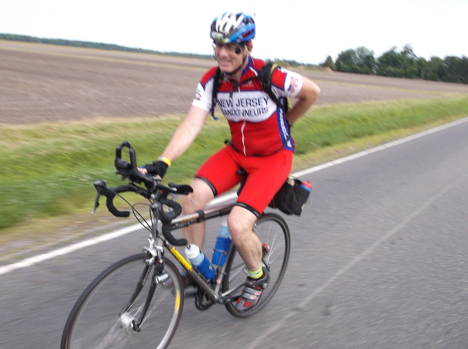
Just past the middle of October my RUSA kilometer total reached an even 9800k.  Just 200k away from K-Hound status.  I'd ridden so many permanents lately that I had a hankering for a regular brevet.  As luck would have it the PA Randonneurs were hosting 200 and 150 kilometer rides on Saturday.  There is generally a good turn-out for their rides, and, I might even know some of the riders.  I informed the RBA, Tom Rosenbauer, I would be coming.  Remembering how hilly the PA rides are I checked the route profile only to have my stomach tighten when I saw the elevation gain to be over 10,000 feet.  Shortly after I received an e-mail from Tom confirming my entry and suggesting I bring low gears.  He was not aware that I've been only riding fixed-gear this year.  I felt committed to the ride but could not help being a bit nervous about it.

I undertook the drive to Quakertown early in the morning to arrive at the Weisel Youth Hostel in time for breakfast.  A nice array of foods were on offer including hot oatmeal. There were a few riders milling about that I did indeed know, although most of them were doing the 150k.  That option seemed very reasonable to me, but would fall short of the total I needed.  I remained committed to the 200k.  A regular PA rider, Johnathan, recognized me and inquired if I was riding fixed.  I confirmed that I was to which he replied with just two words, "Fox Gap", referring to the 1,000 foot climb that appears at mile fifty-five.  I simply shrugged admitting that I expected to struggle.
Riders milling about at the start. Weisel Youth Hostel, Quakertown, PA
I line up with my bike out in front of the building and chat with Chris, a rider from my area.  I would enjoy riding with Chris but she is on the 150k which is mostly on different roads.  Tom makes a few last minute announcements and gives us the off signal.  The group works it's way out on the hard pack dirt driveway to Richlandtown road.  The first miles are on reasonably gentle rolling terrain.  A nice warm-up for a rather perfect day.  The current temperature is in the fifties with the high expected in the low sixties.  At mile fifteen we make the first of several Deleware River crossings at Riegelsville, PA.  A left turn is made onto River Road after the bridge to parallel the river riding on the New Jersey side. We continue to Phillipsburg where we re-cross the river to Easton, PA.  The climbing begins in earnest passing Lafayette college. The rhythm of the fixed gear has not allowed me to match pace with anyone.  I'm riding alone somewhere near the back of the 200k riders, which is where I generally am in the early miles.  Typically I work my way further up the field later on by taking short breaks at the controls and picking up my pace as the day goes on.  I roll into the first control at Wind Gap, Pa.  There is no one there.  I am in and out in ten minutes heading for the top of Wind Gap, and the first of two Appalachian Trail crossings.
Crossing the Appalachian Trail
 I move well up Wind Gap snapping a photo of the A.T. sign while rolling along.  I'm relying on the cue sheet for all navigation as my Garmin froze up after only fifteen miles.  Things go along well until I miss-read a cue and pass by a turn on Cherry Vally Road. I ride ahead through a construction zone. I cover more than a mile before I realize my mistake and backtrack to the point of the error.  From there I manage to navigate flawlessly to the climb up Fox Gap. As I work my way up the two mile climb my focus is on attempting to stay up for the entire time. I make it about 75% of the way before walking becomes inevitable on a particularly steep pitch. About fifty yards later I find a driveway to re-start from and continue on the bike. Shortly I find myself walking again for another brief stretch,  Another conveniently located driveway provides my re-start point.  The road is heavily trafficked making traversing impossible.  I might have made it without walking had it been a quieter road.  I crest the mountain, crossing the Appalachian Trail for a second time,  and begin the fast descent down the other side.  I concentrate on spinning at maximum RPM.  After a few minutes I think to look at the cue sheet for the next cue.  It is an information control followed by a left turn at the TOP OF THE MOUNTAIN!!!  I am now almost at the bottom and I've passed by a control and a turn.  I need to climb all the way back to the top.  I can't believe I could be so stupid as to not have read the cue sheet before this point.  That is just basic navigation which one would think I'd have learned by now.  I find a spot to make a U-Turn and begin the grind back up.  Fortunately the grade is milder on this side and I do not have to walk. I find the sign-post, which is a "truck on cheese" warning.  I answer the question.  Then ride down 0.1 to the turn on Fox Gap Road which puts me back on course headed for the Portland control nine miles away.
Information control at the top of Fox Gap
 After the descent on Fox Gap Road the terrain is mild and pleasant.  Country lanes with low traffic are enjoyed for this short section.  I arrive at the town of Portland and make a left on Route 611 which is the main street through the tiny downtown area.  I've got a keen eye out for the control, a Citgo Mart on the right.  I pass a gas/mart on the right but the name is not Citgo, it is Jersey East, or something like that.  I continue on and am quickly riding next to the river with nothing ahead but trees.  The town is behind me.  After about a mile I realize there is only more of nothing, no market would be located out here and turn back to the town.  I stop at the Jersey East market asking the clerk if it was a Citgo at one time.  She confirmed it was and is still referred to as a Citgo by all the locals.  It's not the first time I have come across that type of cue sheet oddity.  I re-fill water bottles and head back out lamenting about all the time I've lost to mistakes on this ride, mostly my own. 
When not climbing there are always mountains to look at.
Leaving the control the cue sheet directs me back through the town. mostly along the river, to a bridge crossing which delivers me to Belvedere, NJ.  After a couple of quick turns I find myself following the river on Foul Rift Road. I  can't help but wonder why in the world anyone would name a road "Foul Rift"?  After a mile or so the answer comes to me in the form of a large cooling tower for a Nuclear Power Plant.  It's situated on the banks of the river right next to the road.  I get the joke.  There are some homes on the road.  I'm betting the residents aren't exactly in love with their address.  Sort of lacks that pleasant ring to it like say "Deer Run Road", "Shady Tree Lane" or "Apple Blossom Way".  I quickly cease thinking about these things as Foul Rift kicks up to a very steep, but kind of short hill.  I can confirm that being in close proximity to a nuke plant does little in the way of adding strength to one's legs.  I had always thought that the Incredible Hulk got his strength from exposure to nuclear radiation.  I assume one must actually be directly exposed to the reactor core to get the effect.  None the less I manage the hill without dismounting.  The remaining mileage to the control in Bloomsbury is pleasant and uneventful.  I arrive at the quiet general store needing only to re-fill a water bottle.  I have given up hope long ago of catching up with any other riders.  The extra mileage, combined with slow climbing and descending have relegated me to the position of Lantern Rouge.  At this point I'll be happy just to finish without too much riding after sun down.
The sun on it's way down.
 I'm out of the control within five minutes.  After only one half mile I hit Milford Road.  This last section is supposed to be quite challenging.  Milford Road kicks up very steep, then merges into Staats Road which is also quite steep and long.  I manage the climb by traversing on some of the steeper parts.  It's about two miles of tough grinding and I'm very pleased that I made it all the way without clipping out.  There is a pleasant descent down Sweet Hollow Road which soon after I cross the Deleware at the Milford bridge back into Pennsylvania.  After a brief run along the river on Route 32 I'm directed on Red Cliff Road a wall of hill which I cannot manage without walking.  This is followed by another steep kick on Upper Tinicum Church Road.  After some descending a turn is made on Geigel Hill Road.  This starts out very mild for a portion of it's three mile length.  Just as it lulls one into complacency it rears up to be incredibly steep.  Once again I find myself on my feet pushing the bike until the grade lessens.   After descending into the valley the terrain is mild until the last few miles of the route.  After a shorter manageable climb up Elephant Road I find myself at Lake Nockimixon.  I notice that the official time for sun down is just a few minutes away.  To comply with the rules I stop to put on reflective gear and turn on my lighting.   The finish is just on the other side of the lake. To get there requires one more climb on Route 313, which I've done many times before.  It goes by easily and I arrive at the youth hostel just minutes later.  There is still a small amount of daylight left.  Tom appears happy to see me.  With my arrival the finish percentage became 100%.  My time is 10 hours and 58 minutes.  I'm happy to have finished what is my most challenging fixed-gear 200k to date.  Also, I'm thrilled to have earned the K-Hound award for the second time.   

Epilogue, Plans and Goals
  
I've done far more solo riding this year than ever before.   The fixed-gear is isolating, unless riding with other fixies.   I enjoy riding with others, but have learned to appreciate being alone as well.  I'm not reliant on companionship to enjoy a long day on the bike.  I've become proficient at controls.  Managing to  keep my time off the bike to a bare minimum on most rides.   Due to an affliction known as ADD I've not been the best at navigation.  When I ride a new route, alone, it is highly possible, even likely, I will  make an error adding additional miles to the distance.  Usually it is a miss-read of the cue sheet that causes this.  I've since purchased a Garmin and am slowly learning how to use it.  Hopefully, this will help, but it is not a simple device to use.  At least not for me.  

It was satisfying to reach the K-Hound level again this year.  With the difference being that I have ridden only fixed-gear for every kilometer in 2012.  I am planning to travel to Texas next month for a 600k hosted by the Lone Star Randonneurs, the original K-hounds.  I'm much looking forward to meeting them, and riding with their group. 

To finish off the year I hope to ride at least 1,000 more official kilometers which will put my all time RUSA total to 40,000, which is known as the Mondial level.  A finish of the Dallas 600k will complete a second SR Series for me, this year.  Two thousand more fixed-gear miles by the year end will bring my total to 14,000 for 2012.  The R-12 quest is still intact with 45 consecutive months accumulated so far.  The P-12 stands at 22 consecutive months.   All of it is lots of motivation to keep me riding as the weather turns colder.  
Boo-ya!


Friday, September 14, 2012

New Jersey State Record Crossing (East to West)


The wind feels cool blowing through my one piece cycling suit.  It's just a few minutes past eight on a cloudy Sunday morning.  The aforementioned wind is coming off the Great Bay in Little Egg Harbor Township, New Jersey.  I'm at the center of a small gathering making final preparations to ride my bike to the western end of the state where the pavement will end at the Delaware River, some eighty miles from the starting point.  The purpose of the gathering is to attempt to break a standing UMCA record for crossing the state from east to west.  That record stands at 5 hours, 55 minutes.  I'm hoping to beat that time by a substantial margin, perhaps an hour or more.

At thirteen minutes past the hour I'm ready to go.  My nervousness begins to fade away as I turn the pedals on the Specialized Langster fixed gear.  My wife, son and David, the UMCA official, pile into the follow vehicle to trail behind me.  This is a requirement for a UMCA record.  I question whether it will be a distraction.  As it turns out I quickly forget it's there.  Focusing on maintaining a brisk pace for the miles ahead requires most of my concentration.  With the remaining mental capacity I am making sure I don't miss a turn.  I am to stay on Great Bay Boulevard for over six miles.  The area is very open and quiet at this early hour.  I can see the water to  my left.  There are multiple narrow bridges with traffic lights to ensure no two vehicles meet on the wooden section, which is only wide enough for one vehicle.  The UMCA rules require adherence to all traffic laws.  I lose a couple of minutes waiting at these lights, even though no vehicle comes through.  After crossing US-9 I am headed to the heart of the Pine Barrens region.  This is a good place to be when the wind direction is opposite of helpful.  The trees make a nice blockade allowing a steady pace to be maintained.  My goal is to manage the full distance without a stop.
Waiting at one of many traffic light crossings
 With the follow car safely in tow we roll through Green Bank and Elwood arriving at US 322, White Horse Pike.  Thirty-two miles are behind us, we remain on target.  After crossing the highway at a jug-handle intersection on Malaga Road I signal my crew for a hand-off water bottle.  We never practiced this from the moving vehicle, we only discussed the safest way to do it.  The exchange goes smoothly with little to no time delay.  My wife is the support person in the back of the HHR.  She is responsible for hand-offs and is helping me with navigation.  Periodically small slips of paper with turns for the next ten to twenty miles are passed to me.  I clip them to the bar to keep track of the route.  When we pass the forty mile point without any major mishap my confidence begins to soar.  I had driven the route two weeks ago.  Doing so is proving extremely useful as I recognize many of the landmarks where turns are located.  Combined with the small cue-sheets I'm being handed from the support crew all is going smoothly.  
Official UMCA follow vehicle
 After a sixteen mile stretch on a single county road, CR 690, we find ourselves close to fifty miles.  With about thirty left to the finish.  It looks as if we are going to shatter the record.  Although, I'm trying hard to block out that thought.  I think about the expression "counting chickens before they hatch".  I need to concentrate on nothing but staying on course and giving what I can to the momentum of the bike.  

Soon enough I begin to see the cooling tower of the Salem Nuclear Plant looming up ahead with steam steadily flowing from it's top.  Our destination is quite near the plant, which uses the Delaware River to cool the reactor core.  The wind has picked up quite a bit, and for now, I am right into it.  With about ten miles left I pick up my effort to compensate.  Mostly, it is effective.  My average speed is holding fairly well. 

The final miles are exposed land, mostly corn fields.  When the turn for Fort Elfsborg road comes up I know we are within a few miles of the end.  The road twists its way through some farmland and makes a hard left to become a residential road.  I fly by the small houses until the tiny park at the end of the road is in sight.  Not much point in sprinting , but, for the benefit of the crew I pump my fist int he air as I hit the transition from road to dirt, which is where the land yields to the river.  We have taken more than 1.5 hours off of the existing record using a fixed-gear bike.  Needless to say we are a happy little group at the finish.  The finish time is 4 hours, 27 minutes.

Epilouge:
At the finish on the Delaware River.  Notice the flags.

A hug for the crew chief and vehicle driver, my son Charlie

Left to right: David, UMCA Official, Charlie (son), Crew Chief, Lucy (wife) support crew 
 A UMCA event is an unusual practice for me.  The past seven years have been largely spent randoneuriing.  While much has been accomplished in that time the repetitiveness of the activity can make one weary.  Something different than the routine can be refreshing.  Preparing for the record attempt took incredible time and energy.  And, much of it was off the bike.  In fact, meeting the UMCA paperwork and vehicle signage requirements where quite time consuming.  As was designing and driving the route.   With the experience gained in this successful attempt I feel that future participation will be easier.   There are literally scads of records across the country that are ripe for the picking.  I'm hoping to find the time and a willing crew to take a shot at another one.  Stay tuned.  

Boo-ya!                                                                                                                                                                                                                                                                                                                                                                                                                                                                                                                                                                                                                                                                                                                                                                                                                                                                                                                                                                                                                                                                                                                                                                                                                                                                                                                                                                                                                                                                                                                                                                                                                                                                                                                                                                                      

Wednesday, July 4, 2012

New Jersey East Creek 600k - Fixed Gear R-80


 When I first heard about the Cyclos Montagnards and the R-80 recognition for finishing brevets in 80% of the official time limit I thought it was a silly idea.  Randonneuring is a non-competitive activity.  The proposed concept seemed to contradict this. After time the purpose of it finally dawned on me.  The point being that after years of brevet participation one can become a little bored.  New challenges are welcome.  This year I participate in all rides on a fixed-gear to raise the level of difficulty.  Combining that with the 80% time goal makes for a worthy challenge.  One I was never confident I could manage, for a complete series.  Without specifically trying I posted times faster than the R-80 limit on two 200 kilometer rides, one 300k, and on two 400k’s so far this season.  All that’s needed to earn the recognition is the 600k.  The time limit would be 32 hours instead of the usual 40 hours.  For me, on the fixed-gear, that would demand riding straight through.  A totally sleepless event, something I’d never done before.  My confidence was low the week leading up to the ride, but my desire held strong.  I was determined to give it my best effort.  If it didn’t work out it wouldn’t be for lack of trying.

Hightstown to Browns Mills - 54 Miles

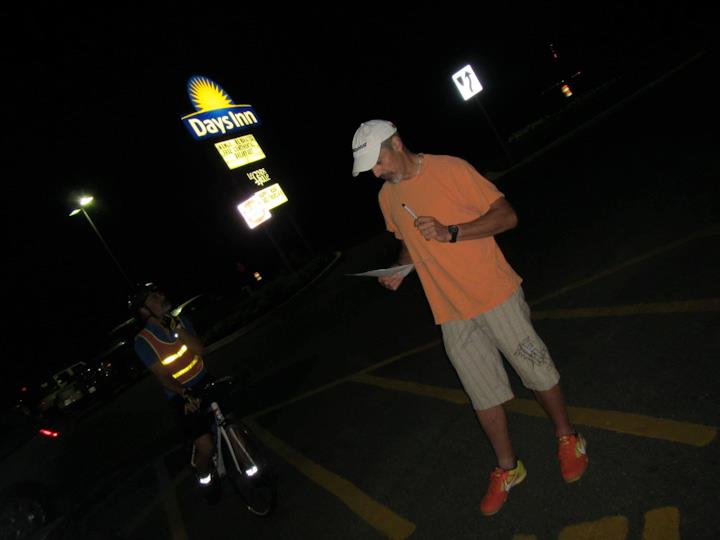
My dislike for 4am starts mattered little as I line up with 15 other riders in front of the Days Inn at Hightstown.  It’s a pleasant morning with mild temperatures and no wind.  A few last minute announcements from organizer Rick Lentz and we are given the go signal.  The field of riders quickly departs for points south.  I know better than to try to hang with a large pack of geared bikes.  I relegate myself to the last position and watch as the group moves away from me.  I enjoy the solitude of those first miles in the darkness.  I see a bike lamp coming up from behind and am quickly joined by my friend Paul, who got off to a late start by a few minutes.  We ride together as the skies begin to lighten and daylight slowly overpowers the darkness.  We come across Todd at the side of the road.  He is in the final stages of repairing a flat on his rear wheel.  We stop to assist with Paul loaning him a high-pressure frame pump.  Quickly we are underway with Todd joining us.  This part of the route I have ridden many times before.  The roads are utilized by a number of other rides.  We efficiently cover the final miles to the Wawa where three volunteers are awaiting our arrival.  We are the only riders there.  The rest of the group is gone by about 15 minutes.  We keep our time at the stop short..
Paul rolls past New Jersey farmland

Browns Mills to Williamstown – 56 Miles

Leaving the control we are in the vicinity of the Fort Dix/MacGuire military base.  Trucks buzz by and aircraft scream overhead.   There is considerable traffic for the first two miles.  Then we turn off onto quiet country lanes.  We pass by the Brendan Byrne State Forest and turn onto Buzzard Hill Road.   I don’t recall seeing any buzzards, or any hill for that matter.  Soon thereafter we pass by Nixon’s General Store.  We spot two riders stopped in front.  They are preparing to depart as we pass by.  It takes them a few miles to catch up.  One of the riders, Justin, is on a recumbent.  His riding companion, Bob, is on his first 600k brevet.  Both riders are from Maryland.   They ride with us for a bit until they fall off the pace shortly before the control.  We arrive at the Wawa to be greeted by my friend and fellow randonneur Nigel and his daughter who is enthusiastically ringing a cow bell in our honor.  By prior agreement we intend keep the stop to 10 minutes.  After refilling water bottles I am ready to go.  Paul and Todd are both mixing drink powders.  When we reach the 10 minute mark I tell them I have to roll.  The desire to be moving forward is overpowering.
Todd cruises through the Pinelands
Justin from DC on the Recumbent

Williamstown to Salem – 33 Miles

I leave the control feeling bad about the situation.  But, standing by idly when I know I need to keep moving caused tremendous anxiety.  I just have to be rolling.  I wait for the traffic light to change at the intersection of Black Horse Pike.  I look back to see Paul heading from the control.  I pedal slowly and he catches me quickly.  Unfortunately, Todd does not get out in time to catch back up.  I hope I will see him later.  Paul and I average a nice pace over the moderate terrain moving closer to the very western part of the state where the river separates New Jersey from Delaware.  We come across Jon and Katie who are working on the tandem on the side of the road.  The stoker’s crank arm has come loose.  We help them get it straightened out.  In short order we are back underway towards the control.  After a few miles riding together the tandem falls off the pace a bit.  Paul hangs back and I put a bit of a gap on them.  I hold my pace arriving at the control slightly ahead of them.  The volunteer, Laurent, checks me in.  I decide to eat a slice of pizza.  Katie, Jon, and Paul arrive and settle in.  Paul says he is not feeling well.  The day has warmed considerably.  I’m guessing he is suffering from the heat. He’s not certain whether he should continue.  When I am ready to leave Paul says he will depart soon with Katie and Jon who agree to stay with him.  It’s a plan I can live with.  I hate to leave him, but I need to keep moving.  I see Todd on his way in to the control as I head out. 
Katie & Jon riding with Paul en-route to Salem
 Salem to Newfield – 37 Miles

Much of the 600k route was changed for this year, the current section being entirely new.  I’m using the electronic cue sheet device for guidance.  After navigating for a few miles I’m passed by Michelle, who was at the last control at the same time as me.  I avoid the temptation to match her pace. There are more than 200 miles left which I plan to cover without rest.  I stick to the ride plan and hold my current speed.  After a few miles she disappears out of sight and the temptation is gone.  The remaining miles to Newfield pass by without incident.  In fact, I found the section quire pleasant.  On arrival at the control I am greeted by Jim, a regular volunteer from the southern jersey contingent.  He points to a rider sitting on a park bench nearby and tells me he is dropping out.  After completing my check-in I walk over to talk to him.  He is Rudi from Philadelphia.  I recognize him from other rides.  Rudi explains that he was caught up with the lead group and rode faster than was reasonable given the hot weather.  I assure him that he can recover from the mistake.  I invited him to leave the control with me. I promise to maintain a moderate, but steady pace.  He agrees to join me. 
Rudi smiling through some of the many miles
Newfield to Ocean City – 38 Miles

As promised I keep the pace moderate with Rudi following on my rear wheel.  We ride that way until he finds his legs.  At which point we spend some time riding side by side and chatting.  I tell him that I’m planning on riding through the night without sleep. He thinks it sounds like a good idea to beat the heat that’s forecasted for Sunday.  His intent is to join me if he feels up to it.  Despite using the ECS we miss a turn.  It takes about one mile before I realize we are wrong.  By the time we get back on course a rider from behind has gotten by.  We see him just ahead.  I recognize him as Sam from New York.  We catch up and ride together as the scenery changes to more shore like surroundings.  We traverse two bridges which are high enough to be considered climbs.  We arrive at the Wawa control together.  The volunteer, Dawn, verifies our brevet cards.  I suggest to Rudi that we keep the stop brief. 
Rudi and Sam en-route to Ocean City
Ocean City to Eldora (Sleep Stop) -   22 Miles

After a quick bite the three of us get underway headed to the sleep stop.  We are now in full darkness.  We negotiate our way through the busy streets of Ocean City and over another bridge crossing.  Sometime later the surroundings become more wooded and rural.  The sleep location is a large cabin capable of accommodating 15 people.  I have a drop bag with fresh cycling kit waiting for me. My plan is to eat, freshen up, change, and depart as quickly as possible. I budget a half hour for the stop.  Discussing the plan with Rudi along the way he indicates he is game to ride through with me.  The sign for the East Creek Cabin leads us to a gravel road of about 100 yards which ends at a rather large wood cabin.  We are quickly checked-in by Rick and Walt then given our drop bags and shown around.  Another volunteer brings me a bowl of vegetarian chili.  I sit at a large table and fill up on the food.  There are three riders there, one asleep in the bunk room.  Michelle and Patrick are the other two who plan to take some sleep there. I learn that Paul has dropped out at the prior control.  It takes 45 minutes for Rudi and I to get everything done.  We depart together into the quiet night knowing there are three riders who are on the road ahead of us.

Eldora to Hammonton – 36 Miles

As we close in on midnight I felt the first signs of sleepiness setting in.  Thankfully Rudi has an I-Pod on his bike with small amplified speakers.  In the quiet of the Pine Barrens I can clearly hear the songs.  We ride side by side undisturbed by any vehicle traffic.  The classic rock tunes keep me going, I find myself singing along to much of his playlist. Navigating is the other function that helps me stay alert.  The directions seem confusing at times.  Mostly, because my mental function is reduced by fatigue.  It takes lots of concentrating to keep from going off course.  At one point a road name changed without being noted on the cue sheet.  We stop to consult my GPS cell phone to confirm our direction is correct.  I cannot afford any more bonus miles if I am to finish within the desired time frame.  We arrive at the Hammonton Wawa at about 3:00am.  Bob, the volunteer on duty, meets us in front of the store.   I need to adjust my chain tension.  I can feel the slack in it while pedaling. I realize there is no more room in the dropouts to move the wheel back.  The chain will have to be shortened to make it work.  Bob has the tools on hand to accomplish this and offers to help get it done.  We work together for about one-half hour before it’s accomplished.  Rudi and I leave the control at 4:00am, one hour after arrival. 

Hammonton to Vincentown – 46 Miles

An unspoken goal I’ve had in the back of my mind for a long time is to ride 300 miles within 24 hours. I thought it might happen on this ride.  The opportunity slips away due to numerous unpredictable time management issues. Most were unavoidable.  I’m a little bummed as the 24 hour mark passes with only 283 miles in the bank.  I then focus all my thoughts and energy on achieving the bigger goal of the R-80 Series.  I intend to keep a steady pace to the next control without stopping.   

Amazingly daylight begins to break through at about 5am. This helps me feel a little more awake.  Rudi is hanging in there, but mentions he would like to take a long break at the next control.  I won’t be in a position to spend more than a few minutes there.  We both have different agendas and knew at some point we may have to separate.  We helped each other get through the night.  At this point we would each finish the ride on our own terms.  I begin to recognize the surroundings shortly before the control.  We are very close.  After crossing US 206 we enter the Wawa Market and are immediately greeted by David.  After getting our cards verified Rudi lays down on the grass in front of the store.  David says he’s been told about my time goal.  He encourages me to go for it.  He tells me the actual mileage to the finish is a bit shorter than what the cue sheet indicates.   I know this isn’t true, but I appreciate his attempt to bolster my confidence.   There are three riders ahead, but too far up for me to hope to catch anyone.  I will have to finish the last section on my own. 

I want something to eat other than a Clif Bar.  I dash into the store and grab the first thing that looks good, which is an individually wrapped mini pie.  After paying for the item I jump on my bike and head out with the pie in my back pocket.  My total time spent at the control is seven minutes. David wishes me luck. Rudi appears to be sleeping in the grass as I ride out.

Vincentown to Hightstown – 49 Miles

My departure time from the control is 7:30am. I need to arrive at the finish before 12pm.  That seems like a lot of time to me.  But, I’m quite tired and the final section of the route features some climbing.  I tear open the fruit pie and devour it while riding through a flat section. Soon thereafter I feel an energy surge from the sugar.  I’m riding strong and feeling pretty alert.  After quickly knocking off  twenty miles I feel a big letdown.  I know the energy burst from sugary foods ends abruptly.  I’m now in a mini-bonk.  My speed slows to 11-12mph on flat terrain. I quickly consume a gel, with caffeine, and a Clif Bar.  It takes about twenty minutes before I feel the effect.  My speed picks up and I begin to feel better on the hills that are increasing in frequency.  I’m passed by a local rider, not affiliated with the 600k.  I acknowledge him with a casual nod and a wave.  I’m sure I look like a zombie at this point.  We hit a steep kicker and he slows up, shifting into an easy gear.  I pass by him in a standing climb pushing my single gear up the hill.  I’m sort of hoping he catches me again.  I would like to ride a few miles with someone to talk to.  It would be very helpful.  Unfortunately,  he never catches up and I can’t take the time to slow up.  The one hill I’m dreading is quickly approaching.  Aggress Road at mile 368 is the most substantial climb on the entire route. It’s not a terribly hard climb, if encountered on a routine training ride.  After 30 hours it leaves a lasting impression.  I’m grateful when I reach the top without a problem.  Also, I’m very happy my earlier chain repair held up under the strain.  With Aggress behind me I’m confident of a successful outcome.  My mood is jubilant for the last eight miles to the finish.  When I make the final turn to the hotel I sprint it in (sort of).  Kyle, Bob, Rick and Walt greet me under the canopy.  My card is signed at 11:17am, forty-three minutes before the R-80 cut-off.

Epilouge:

I learned later that Rudi finished successfully.  He rested for two hours at the Vincentown control, waiting there for the next rider, Sam, to arrive.  They rode together for most of the last section. I also heard that my friend Todd had passed out at the sleep stop falling to the floor. He was suffering from heat exhaustion.  After some substantial rest he resumed the ride finishing in good shape.  Jon and Katie also finished after taking sleep at the cabin. A total of fourteen riders completed the 376 mile course, despite hot weather.

With the R-80 Series complete I am looking forward to the next challenge.  I am planning to traverse the entire 444 mile Natchez Trace Parkway from Nashville, TN to Natchez, MS in late September, on a fixed gear.  I’ve not fully decided how aggressively I wish to undertake the ride.  My instinct is to try and kill it with a straight through effort.  Possibly setting a fixed-gear record for that stretch of roadway.  I doubt one currently exists.  A straight through ride at any speed would be the initial benchmark.  I just need to work up the motivation to give it the effort. 
Boo-ya!

Tuesday, June 12, 2012

New Jersey 400k - Volunteer Pre-Ride

 Without even a full week passing I find myself undertaking another long ride.  In keeping with my annual obligation to organize a brevet for my fellow New Jersey Randonneurs, I agreed to pre-ride the 400k route just one day before the calendar event.  Accompanied by RBA, Katie, and volunteers Jon and Paul we would take to the roads at 4am on Friday.  We would need to be available to check-in riders at 3am on Saturday.  A 400k has a time limit of 27 hours.  In order to meet our obligation we would have a self-imposed limit somewhat shorter than that. 
Paul passing New Jersey crops
Jon and Katie would team up on the Co-Motion tandem, with Paul riding his geared Lite Speed.  I would keep the status-quo with the Jamis Fixed-Gear.  Things went remarkably well for us including good weather.  The route, mostly unchanged from the prior year, presented no problems.  The controls were all in place including a new control for the return through the Pine Barrens, The Green Bank Tavern.  Which turned out to be the highlight of the day, featuring a comfortable air-conditioned environment and wonderful food.  After spending about 45 minutes re-fueling there we were pleased to know this stop would be available to the riders the next day.  Sometime later we transitioned to night riding.  The temperature remained mild and we rode comfortably through the remaining wooded area to the penultimate control in Vincentown.  The final 35 miles were covered slowly.  Paul became dangerously sleepy and decided to nap in the protection of a school entrance.  He insisted we keep riding and asked that we call his cell phone in 15 minuted to wake him up.  Jon made the call from the back of the tandem while we rolled to the finish.  We arrived at 12:13 am with Paul finishing about 15 minutes later.
Jon and Katie at the deli just past Batsto
The train graveyard
Katie smiling through the Pine Barrens
 There would be precious little sleep time before our volunteer duties began at 3am, but it would have to do.   After two hours of sleep Jon, Katie and I would begin another long day seeing a group of 21 riders successfully around a 400 kilometer.  Paul would arrive later to handle the late night duty of the final finishers.  A task that required him to remain all through the night until 6am to greet the final finisher, a man riding a hand-cycle.   
Pre-ride announcements at 4am
Epilogue:

Being the organizer, or volunteer, at a brevet is a time consuming but rewarding experience.  It's enjoyable helping others to meet their goals.  The riders appreciate the support and encouragement given to them by like minded folks who know what they are experiencing and how to help.  It makes quite a difference when a rider is having doubts about their abilities.  I have been on the receiving end of such encouragement many times.  It's nice to have a chance to give some back.  
Boo-ya!

Tuesday, May 22, 2012

The Shiftless Vagabonds - NYC to Westfiled, MA Fleche

The Fleche is one of the most unique rides in all of cycling.  Participants are counted as number of bicycles and not riders.  Therefore, the number of persons on a team can range based on the carrying capacity of the maximum number of  bicycles (5).  No specific route or checkpoints are provided by the organizer.  Only a finishing location and a range of starting dates/times are pre-determined.   The route design, the starting location, and exact start time is the responsibility of the team.  The distance is to be a minimum of 360 kilometers.  The control points are also determined by the team including the all important 22-hour control which is to be no less than 25 kilometers from the finish.  The team must depart this control 22-hours into the ride and arrive together at the finish.  No more than two hours can be spent at any rest stop.  At least three team members must finish for credit.  Only those who finish receive credit, and no team member can finish earlier, or later, than the rest of the team.  The Fleche is considered a 24-hour event.  Each team must present a team name at the time of their entry.

I would have the pleasure and privileged of being on a team with four veteran randonneurs.  After much debate we settled on the team name of Shiftless Vagabonds, depicting our commitment to ride fixed-gear bikes.  We wanted to honor the original Fleche concept of a point-to-point ride.  We selected New York City's Penn Station as our start. Team Captain, Mordecai Silver, designed a route which avoided much of the severely hilly terrain through upstate New York, Connecticut and Massachusetts.  Our designated start time was 9am on Saturday for a Sunday morning finish in Westfield.
The D&R Canal at Blackwell Mills Crossing on the way to the New Brunswick train station
My team mates where, Roy, Jon, and Mordecai (team captain).  We used our bikes and public transit whenever possible.  I would share a ride on the train with Roy to meet the two New York City resident team mates at Penn Station.

We started the ride on 7th Avenue in Manhatten utilizing the Greenway bike path along the river.  We would spend many miles on bike paths making our way to the north.  Our first 100 kilometers were almost entirely on paved trails to the town of Carmel, NY.   We continued our northerly trek utilizing both roads and trails through Millerton, NY and into Connecticut.  A rolling section on Route 44 would deliver us to New Canaan, Ct. 117 miles into the ride.  From there mostly gentle terrain would take us to North Adams, MA, near the Vermont Border.  We arrived around midnight and spent time at a 24 hour McDonalds   After a lengthy break we would undertake the hilly portion of the ride, including a 3-mile climb with gradient about 9%.  As cool temperatures set in we plodded on to the 22-hour control in Northampton, MA.  The rules required a 7am departure.  We would spend over an hour and a half there awaiting our opportunity to move on to the finish.  We did so promptly at 7am.  The final section was mild., as the day rapidly warmed up.  We arrived at 8:15 in Westfield for the finish.  Another team arrived shortly thereafter having ridden south from Vermont.  One of the riders Bill Russell is a regular on New Jersey brevets.

Roy, Jon and Mordecai on the North County Trailway
Roy catching a nap at Bruegers Bagels in Northampton, MA
 Roy and I would ride 10 miles to Springfiled, MA to catch a Peter Pan bus to NYC.  Incredibly Jon and Mordecai rode 65 miles to New Haven, CT to catch a train.  It was pleasing that despite finishing a ride far from home no one relied on a private vehicle for transportation.  We may be Shiftless Vagabonds, but we know how to go green. 
Boo-Ya!

Friday, May 18, 2012

Princeton 300k Pre-Ride - The Fixie Challenge


 The fun part of agreeing to undertake this ride was that I wasn't confident I could do it.  I've competed this route no less than four prior times, and, segments of it dozens of times.  This time, I would be attempting it on the fixed-gear.  Not my longest fixed ride, but, in my mind it would be the toughest.  To my amazement three of my four riding companions also agreed to ride fixed.  As the scheduled date approached, and my nervousness increased, the fact that others would be riding with a single cog kept me committed.

I'm not my best at three am.  With all my gear ready, the Jamis Sputnik in the van from the night before, I drive to Princeton Forestall Village, arriving fifteen minutes in advance of the four am start.  The four other riders are there already making final preparations.  I'm riding with Todd, Paul, Roy and Jon.  All but Todd will be on fixed-gear bikes.

The Start
The Village of Kingston at 4:10am
 Exactly at the designated time of four am we take out from the quaint shopping village in the early morning darkness.  The first thirty miles are fairly gentle, a nice smooth warm-up before the difficult miles ahead.  The weather is reasonably pleasant with an air temperature in the low fifties and moderate winds.  The humidity is high causing a misty fog.  We spin quietly on roads that are totally void of traffic at the early hour.  At times chatting with each other, but mostly just taking in the pre-dawn stillness.  An overcast sunrise begins just prior to our arrival at Whitehouse Station.  The designated control is the Bagel Junction in the Whitehouse Mall.  We take the opportunity to partake in a nice breakfast of freshly baked bagels.  While enjoying the respite we discuss the severity of the terrain on the next section.  The four of us riding fixed are figuring there are hills we will be forced to walk.  For at least some portion.   We all agree that Ryan Road in Petersburg will likely be the first to take us out.  Although, there are significant hills to climb before we get there.

Whitehouse Station
Todd (L) and Roy (R) at Bagel Junction, Whitehouse Station
 Reluctantly leaving the comfortable environment of the bagel store we cross US-22 headed towards Oldwick.  We work our way to Rockaway Road, which is a slightly uphill run along the river to the tiny town of Mountainville.   The first lump of the day appears on Guinea Hollow Road which brings us up to Route 512 near Califon.  While not a particularly difficult climb it is followed by a long fast high-cadence descent into the small town.  With little chance to rest the legs we take on two quick kickers which lead to Route 513.  A quick turn-off is made on Sliker Road. This begins a long challenging climb along the side of Point Mountain.  We all manage to stay upright for the entire climb.  A fast twisty descent to the Muscenetcong River follows on Point Mountain Road.  We cross US-31 near Washington climbing again up to Rockport Road where we enjoy a pleasant rolling stretch into Hackettstown.  Each mile brings us closer to the first real steep climb at Ryan Road.

Ryan Road
Roy and Paul walking Ryan Road
 Traversing the western half of the town of Hackettstown on US-46 we climb up to Liberty Township.  We turn-off on Petersburg Road and are quickly met with more steep kickers.  A long gradual descent leads us to the turn onto Ryan Road one-half mile before the climb.  Todd has fallen back.  We all wait for him at the bottom of the climb, delaying the painful experience just a bit longer.  When he arrives we immediately start up the hill.  The road pitches up sharply very early on.  It is all I can do to turn over the pedals until finally I feel stuck.  I don't have the strength to move the pedal to the bottom of the stroke.  Clip out, or fall are my choices.  With little desire to break a hip I take option one (clip out).   With feet firmly on the ground I look around to see my fellow fixie riders walking their bikes up the steepest section of the hill.  Score one for the mountain.  No one with a single cog stayed on for the entire climb up Ryan.  Todd successfully climbed the hill with gears.  Once at the top a fast descent delivers us to Allamuchy.  We pass by sod and chickory farms on gentle terrain.  Interstate 80 is just off to our right.  The traffic there seems out of place in this farm community.   I'm happy when we enter the small town of Johnsonburg and can no longer see or hear the interstate.  We pass through the sleepy town headed for State Highway 94.

 Stillwater Loop
Despite running the biggest gear of the group Jon climbed strong all day
 Once Route 94 is reached signs pointing the direction to Blairstown lead one to believe the control is near.  Unfortunately, a cruel joke is played at this point.  The cue sheet quickly directs riders to the north for a little venture known as the Stillwater Loop.  This is twelve miles of challenging terrain in one of the northern most regions of the state.  A substantial climb on Sunset Lake Road comes at a time which makes it hard to enjoy.  None the less it is climbed successfully by our entire group.  There is a payback for the effort which is in the form of breathtaking scenery.  Millbrook Road has a view which seems to go on forever.  The remaining miles to Blairstown pass uneventfully.  We are soon enjoying a hearty lunch at the Gourmet Gallery in the small downtown area. 

Jenny Jump
Pain and suffering ahead
The departure from Blairstown comes with the knowledge that one of the most notorious climbs on the course is looming in the distance.  Seven miles of somewhat hilly terrain bring us to State Park Road, and the start of a long steep trek up the Jenny Jump mountain.  Roy and I are climbing together.  Jon is a bit ahead.  Both Paul and Todd are a bit behind.  Roy announces the percentage of grade as reported from his Garmin.  We are climbing fine until we exceed 16% of grade.  We are once again relegated to walking.  We watch in awe as Jon continues the climb, without walking.  We only walk a short way until the grade lessens.  We resume riding to the top of the climb.  What follows is a screaming descent down to Route 611.  After which we enjoy mostly moderate terrain to the information control at the Anderson Hotel in Washington.
A grimace on his face as Paul tops Westervelt Road in Washington

Penwell Road
Roy and Jon re-grouping at hill top
From the turn off Route 57 in Washington to the top of Schooley's Mountain involves six miles of climbing on Penwell Road.  The initial section, near the YMCA camp, is quite steep for about one mile.  After which the remainder of the climb is considerably more moderate.  All of the day I was thinking that the steeper section of Penwell would be too much for the fixed-gears.  To my surprise we all made it without dismounting.  When the gradient eased I felt strong and pushed a bit on the remaining miles to the top.  I rather enjoyed the climb and a nice break at the General Store conveniently located at the apex of the mountain. 

 Hacklebarney State Park

After a bit of rest at the store we descend off the mountain into the town of Long Valley.  From there it is a short distance to Califon, where there is an information control followed by the final big climb of the day.   The slow, steady grind up Route 512 actually buoys my spirits as I know that this is the last of the extended climbs.  All riders make the climb upright.  We continue on to Fairmount, near Chester and the control at Hacklebarney.  Once on State Park Road we hit a few smaller hills, but nothing compared to what we've been through.  Basically, the severe terrain is behind us.  Upon arrival at the control we are greeted by Todd's friend Leslie, who has graciously volunteered to provide food and drink for our small group of pre-riders.  We relax and enjoy warm slices of Pizza.  After a nice break we reluctantly resume the ride.  We have a couple of hours of daylight left and forty-five miles to the end.  We plan to make an optional stop at Three Bridges to switch to night riding mode.

Push to the Finish

A few steep kickers hit us on the way out of the park.  After which we manage with a long, bumpy downhill into Pottersville.  This is followed by a run along Black River Road.  We are headed downriver, moderately losing elevation all the way to the crossing of US 22 at Whitehouse.  We pass by the shopping center where we enjoyed bagels many hours ago.  The final thirty-miles from this point follows the identical route as the outbound.  Everything is familiar as we work our way to US 202 at Three Bridges stopping at the Wawa Market.  We keep our stop brief departing with lights and reflective gear functioning.  We still have some daylight left although the sun is quickly sinking.  Like horses to the barn we are covering ground quickly and efficiently.  We reach the tiny town of Neshanic Station as daylight yields to darkness.  I've ridden this section so many times I've no need for a cue-sheet.  Methodically, we work our way through South Branch, Montgomery Township, Franklin and Kingston.  The final one and a half miles on Academy Street feels like a sprint.  Although, night riding has the perception of feeling faster than the reality.  None the less we are soon enough at the finish in the Forrestal Village Parking lot.  We took 17 hours and 22 minutes to cover the hilly route.  All said and done it's a successful day on a fix.

Epilogue

My friend, and fellow Randonneur, Nigel Green posted a writing by Jane Flanders entitled the Hard Way.  http://eprider.blogspot.com/2012/05/friday-writings-for-randos-hard-way.html

I found the short piece thought provoking and relevant.   Why would anyone do anything in a manner that would make the task more difficult?  According to Jane Flanders this is done frequently in error, but just as often by intent.  The point being; sometimes it's the difficulty factor that makes something fun to accomplish.

I confess that my fixed-gear season is somewhat of a fluke.  I never originally set out to do this.  It all began when I took a trip west and brought along the fixie as my only bike.  I wound up spending months away from home in a very hilly region with nothing else to ride but a 46x18.  I made the best of it.  And, of a warm winter, by racking up many miles, and RUSA kilometers, on the single cog.  When I finally returned to the east I had little desire to ride anything but the fixed.  I expect at some point that will change, but for now my intention is to take it as far as a can.  Hopefully, accomplishing a full series on fixed, and, possibly a repeat K-Hound award.   With every one of the 10,000 kilometers ridden.......the hard way.        

Boo-Ya!


Tuesday, May 1, 2012

Natchez Trace 400k - Nashville, TN to Cherokee, AL


 After a long stay in Arkansas I finally begin my trip home to New Jersey.  Convenient to my plans is a stop over in Nashville.  By amazing coincidence (not really) I find myself in the Music City the very weekend of the Nashville 400k.  Of special interest to me was the fact that the ride would be held entirely on the Natchez Trace Parkway.  Which, coincidentally, happens to be my favorite cycling roadway of all time.  The ride would begin at the northern terminus of the parkway, in the suburbs of Nashville, and continue for 200 kilometers to Cherokee, Alabama, then return.  I would be using my Jamis Sputnik fixed-gear, the only bike I've ridden so far in 2012.  I've ridden on the famous roadway several times.  The most recent was a 288 kilometer permanent done on the fixed-gear back in February.  I was reasonably confident I would be successful at the 400k distance, although it would be my longest fixie ride ever. 
The highest bridge in Tennessee is on the Natchez Trace Parkway
The 6am start is cool and damp.  The rain which fell most of the night before was evident with wet roadways.  Some twenty riders depart from the YMCA parking lot just a short distance from the entrance to the NT.  Once on the parkway the large group begins to break up into smaller groups.  Some light rain falls during the first ten miles or so, then things begin to dry out.  The temperature is comfortable in the low fifties.    I find myself in the vicinity of Alan, from Memphis and Jeff, the Nashville RBA.  The rhythm of the fixed-gear is different than that of geared bikes so we don't spend a lot of time tightly together.   Mostly, we pass by each other over the rolling terrain.  Which at the northern end is constant.  The geared bikes have the advantage on the downhills and flat sections.  When the uphills present themselves I make up the deficit and pass by.  This process repeats itself numerous times.  Eventually on a series of uphills Alan falls back and never reappears.  Jeff sails by me on a long downgrade and stays out in front until the control.  In the meantime, I catch up to Anthony,  a local rider, who does distance cycling as training for mountaineering.  I listen with great interest as he recounts some of his experiences with mountain climbing around the world.  We ride the remaining miles to the Collinwood control together (mile 90).  There is a good number of riders already there.  I opt for a quick stop.  I leave before any of the others.  I try to get Anthony to leave with me, but he's not quite ready.  I'm sure with the wind being favorable, for the remaining miles to the south, he'll be able to catch me.  I head back to the parkway alone.

I keep my pace steady without working too hard.  There are a few mild grades, but mostly the terrain is flat.  The day is very overcast,  not warm by any means, but for now it is not unpleasant.  Anthony catches me before the Alabama border.  The turnaround point, Cherokee, AL,  is thirty-five miles from the last control.   We're making good time.  It appears we will make the control before nine hours.  As we near the exit we see the first rider on his way back.  Soon thereafter two more riders together pass the other way.  The control is only one-half mile off the NT.  We see another rider depart as we arrive.  We keep our time at the stop short and head out just as a group of four riders is coming in.  Jeff is among the group.  Our departure is right at the nine hour mark.  If all goes dashingly well we hope for a finish by mid-night (18 hours).
Anthony phones home from Cherokee, AL
Back on the parkway we soon see Alan on his way south riding alone.  The wind is now unfavorable, making us cold.  We churn through it as best we can.  Anthony is riding strong taking the lead for a number of miles.  It's all I can do to hang on.  Eventually, that becomes too difficult and he starts to gap me.  I ease up a little to allow the gap to grow letting him  ride his own pace.  I know better than to push myself when there is almost 200k left and it's into the wind all the way.  Settling in to a comfortable rhythm I work my way to the north.  I marvel at how much colder it feels going in this direction.   I begin to look forward to the Collinwood control again.  I want a hot beverage, coffee or hot chocolate.  With ten miles to go before getting there I pass the rider we saw leaving the control.  In another few miles I pass a second rider who pulled off to don a jacket.  I want to put on more layers, but will wait until the stop to do everything at once.  A gradual upgrade for several miles precedes the exit for Collinwood.   The control is less than a mile off the parkway.  The flags on the NT Parkway welcome center are blowing stiffly to the south as I pass by.  I'm happy to be out of it for a few minutes.

Sitting at a table in the store with a cup of coffee I pull out a jacket and reflective vest from my backpack to prepare for the cold.  Darkness will arrive in a couple of hours at which point I expect it to get pretty chilly.  One of the riders I past by earlier arrives saying he is freezing.  A support crew who is waiting for their riders offers him some extra clothing which he gratefully accepts.  Not wanting to waste any more daylight I head back out to the NT.  As soon as I make the turn to the north I feel the cold headwind.  I'm happy to be wearing the additional layers.  There is an optional volunteer manned stop in fifty-three miles at the Gordon House, one of the NT rest stops.  Using the markers on the right side of the roadway I begin counting off the miles.  Daylight slowly begins to give way.  The prediction is for a low temperature below forty.   I'm hoping that it wont be quite that cold by the time I finish.  I cover about half the distance to the Gordon House stop before it is fully dark.  The NT is one of the darkest places I've ever ridden.  There is no artificial light, with the exception of the rest stops.  Occasionally, I hear animals moving about off to the side of the road, but it is too dark to see them.  Thankfully, my lighting system clearly shows me the roadway.  The rolling hills help keep monotony at bay.  There is nothing steep to climb so mostly I'm enjoying the ride.  There is almost no traffic at all.  It is a feeling of total isolation which I have come to appreciate.  An acquired taste of sorts.

I notice a sign for the Gordon House announcing it is two miles further.  As I get closer I see the dim lights of the rest area off in the distance.  There is one car parked there which belongs to the volunteer.  When I arrive he prepares a cup of hot chocolate and offers a variety of food.   The warm beverage really hits the spot.  I munch a couple of cookies for good measure and  head back out.  There are about forty miles left to the finish on the hilliest section of the NT.

I resume the practice of counting the mile markers.  It gives me something to focus on.  Keeping my mind engaged helps me ward off the sleepiness which begins to set in about now.  The rest stop was at mile 408, the end of the NT comes at mile 442, thirty-four of the carved wooden markers remain to be counted.  After about ten miles of rolling terrain a car eases up alongside me.  The passenger rolls down the window and asks if I am okay.  I recognize the car as the support vehicle for one of the riders.  I assure them that I am fine.   I give the situation no further thought as I am way too busy counting mile markers.  At mile 427 my headlight goes dim indicating the rechargeable battery is low.  I pull off at the next bridge to replace it with a fresh one.  The darkness is so total on the NT the task could not have been completed without my helmet lamp.  I'm quickly rolling and my quest of the wooden posts continues.  The largest hills are on the last ten miles.  I feel good surging up them and a little chilled on the way down.  Overall, the effort feels good and the miles quickly pass by.   The post marked 442 is reached with mixed feelings.  The end of the ride is near, but I have no more markers to seek out.  Shortly after the NT comes to an abrupt end at a "T" intersection with McCrory Lane.  The finish of the ride is at a different location than the start.  This requires a final climb to the top of the ridge.  It may be the steepest of the day, although not all that bad.  A private home belonging to one of the volunteers serves as the finish control.  I miss the turn for it and almost descend the other side of the ridge.  Fortunately, before doing this I check my cell phone GPS to learn I had passed by it a half a mile earlier.  I turn around, find my way to the finish, and am greeted by Bill.  A heated and furnished barn, which is more like a bike shop with a variety of machines hanging from the rafters, makes for a fine spot to warm up.  Food and beverages are available.  The support crew is there waiting on their riders.  They comment on my lighting saying I was very visible on the road.  Soon after the two they were supporting arrive.  I learn they are from North Carolina.  We all chat for a bit.  It dawns on me that my car is about two miles away at the YMCA.  Given it is after 2am I decide to call it a day.  It's a cold ride back down the hill.  My starting location at the YMCA is a welcome sight after a long day.

The ride was finished in a time of 20 hours and 8 minutes.  I was genuinely pleased to have completed my first fixed-gear 400k, even if it took a bit more time than I had hoped.    

Epilogue

This was my third official RUSA ride on the Natchez Trace, and my fourth time riding on it.   There is and indescribable draw that the famous roadway has on some riders.  I feel like I need to ride the entire distance.  Every inch from Nashville, TN  to Nathcez, MS.  I am hoping an planning to do this in September.  There is a series of permanent routes that offer RUSA credit for every kilometer ridden.  That would be over 700 of them in one direction.  With the option to double that by reversing the permanents to return to Nashville.  The exact date and ride format is yet to be determined.  Contact me if interested in joining.